I recently needed to find a home for my hero in the fashionable area of London. As most readers of the Regency-era books will tell you, the ton lived in the “West End” of London, or “Mayfair.” In many novels, it seems the hero or heroine lives on Park Lane or Grosvenor Square. But where is that, really?
The West End of London is relatively straightforward (it’s west, right?). The fashionable area in the Regency was north of the Thames, which snakes through London from one end to other. In this West End were Whitehall (government buildings), palaces, shopping areas such as Bond Street, and the homes of the aristocracy. St. James Park and Hyde Park are also in this West End, as well as Carlton House and Pall Mall.
Mayfair is a specific area in the West End named after an annual fair held in that area in the 1600 and 1700’s, when it was primarily open fields or parks. In the late 1700’s, it became a residential area and townhouses and squares were built there.

Grosvenor Square Present(ish) Day Basher Eyre [CC BY-SA 2.0 (http://creativecommons.org/licenses/by-sa/2.0)], via Wikimedia Commons
What is a square, you ask? Literally, a square created by streets with an attraction in the middle, such as a small park, and homes built facing it. For example, Grosvenor Square is so named because a great deal of Mayfair was owned by the Grosvenor family, built up and then sold or leased to others. There were (and are) a number of these squares spread throughout the area.
But I had always wondered, exactly what was Mayfair? How big was it? How many streets did it encompass? In Old and New London by Edward Walford, Volume IV, published in 1878. Mr. Walford describes Mayfair thusly:
Generally, it is bordered by Hyde Park and Park Lane on one side, and Regent Street on the other. Piccadilly is the southern border and Oxford Street is the northern border. Close up, that would be this:

Google Maps
But in the wider view of London, that would be this:
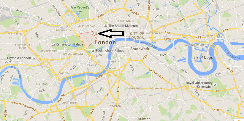
Google Maps
So there you go, “Mayfair” in London. Now, each street within Mayfair and the various attractions there…Well. That’s a post for another day. If you’re curious what was there in the 1820’s, check out Greenwood’s 1827 Map of London. I’ve linked you to Hyde Park and Park Lane, so you’re starting in Mayfair if you choose to “walk” the streets!
Your post is so interesting. I’ve read about those places but never knew where they were. Thanks.
Mayfair was a geographic area I was never quite sure on. I had the gist of it, but actually seeing it on the map was fun! Thanks for stopping by, Diane!